


ADK - Santanoni Range
- Gen-Hike

- 21 mars 2023
- 10 min de lecture
Dernière mise à jour : 30 mai 2023
* English version at the bottom.
High Peak Wilderness. Gratuit. Ouvert annuellement. Chiens permis (non recommandé).
D+1500 m. Niveau : difficile.
Listes : ADK 46ers et Northeast 111 4000-footers
Accès : Bradley Pond Parking Area. Même parking en hiver.
La chaîne de Santanoni comprend Santanoni, Couchsachraga et Panther Peak et se trouve du côté sud-ouest des Adirondacks. Couchsachraga est le plus petit de tous les ADK46 à 3 820 pieds.
Couchsachraga ... "Kook-sa-kra-gr" ... est basé sur un nom algonquin, signifiant "désert lugubre". Loin d'être un désert, son environnement s'avèrera être plutôt humide et détrempés. A moins de vouloir devenir un ADK46er, il n'y a aucun intérêt à s'y rendre.
Petit fait intéressant : Ce sommet est le dernier des ADK46 4000 footers d'origine, mais hélas le pauvre Couchsachraga, se classe désormais à un maigre 59e rang par ordre de hauteur. Il y a maintenant au moins 13 sommets qui sont plus hauts que lui et 2 qui sont à peu près à la même hauteur. Cela est survenu à la suite des enquêtes USGS de 1953 et ultérieures dans lesquelles 4 des 46 d'origine ont été abaissés et un nouveau pic a été élevé au-dessus de 4000. Comme le club ADK 46ers a été formé davantage sur l'optique d'un groupe de personnes partageant les mêmes idées avec un œil pour la conservation et l'appréciation de la nature, plutôt qu'un club de peak baggers, la condition préalable pour devenir un 46er est toujours de grimper les 46 sommets d'origine.
Donc, enfilez vos guêtres et préparez vos bâtons, vous ne vous en sauverez pas !
Randonnée en boucle de 27 km. Accompagnée de mes amis Francis et Pat.
Nous avons choisi d'effectuer la boucle en sens horaire pour aller atteindre le sommet de Santanoni en premier, ensuite Couchsachraga et célébrer la finale ADK46er de Francis sur Panther Peak.
Petit conseil : apportez-vous suffisamment d'eau, car entre Santononi et Panther, même jusqu'à Bradley Pond, il n'y a aucune possibilité de remplissage...
Voici le descriptif de cette épique et boueuse aventure qui nous a surpris par ses conditions quatre saisons :
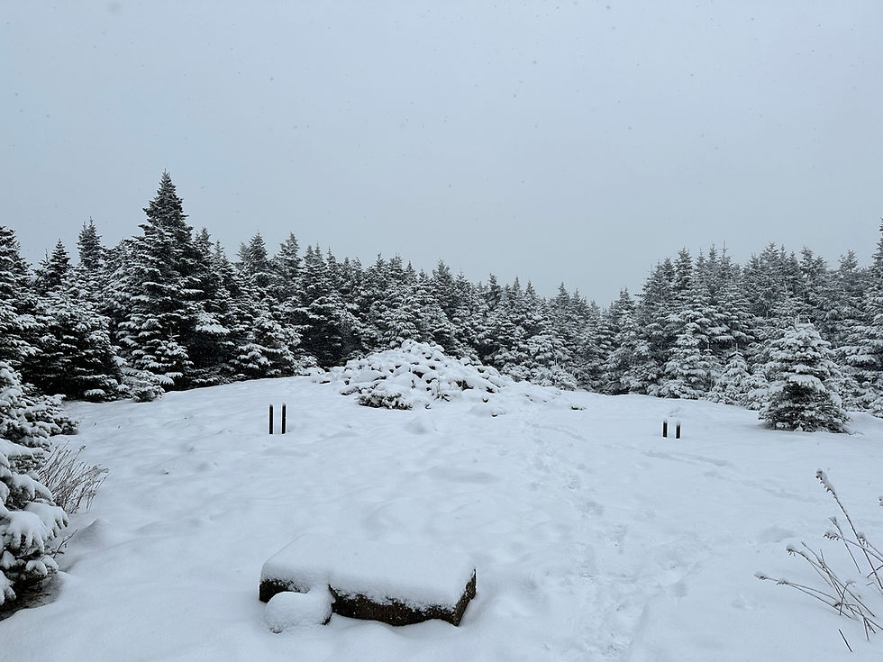
Le sentier débute après une barrière de métal. Le premier 500 m est parsemé de roches parfois roulantes et deviendra plutôt en terre battue avec quelques passerelles sur les prochains 2,7 km jusqu'à ce que vous commenciez à apercevoir le balisage du sentier bleu et où une flèche indiquera de prendre à droite. La route se fait bien et rapidement avec quelques montées et descentes... qui seront un peu plus exigeantes à parcourir sur le chemin du retour avec la fatigue accumulée.
Une fois dans les bois, le sentier serpente jusqu'à un pont de bois d'où commencera l'ascension sans fin. Ce n'est pas raide, mais chaque pas que vous ferez en sera un qui monte, au travers les roches humides sur environ 3 km. Vous arriverez enfin à un cairn indiquant la voie vers Santanoni et Panther. Direction gauche pour rejoindre Santanoni sur 2 km. L'ascension jusqu'à Santanoni sera modérée, relativement longue en temps et il n'y aura aucun moment "plat". C'est sur l'un des murs de roches à franchir que j'ai perdu pied en raison de la glace noire et chuté d'environ 5-6 pieds... On a eu toute qu'une frousse ! Le herd path sera étroit, les épinettes vous frôlerons. Nous étions trempés par toute cette neige sur les arbres. Au-delà de la limite des arbres vous commencerez à avoir une vue magnifique sur l'environnement montagneux. Vraiment très beau !
Juste avant le sommet boisé de Santononi, il y aura un sentier à droite qui descend vers Times Square et le sentier menant vers Couchsachraga. Continuez tout droit (légèrement à gauche) sur 200m pour vous rendre au sommet de Santanoni. Pour un herd path, bien que très boueux, le sentier est très facile à parcourir, mais il n'est pas très large. Cela nous m'a rappelé Street et Nye près du sommet où le sentier se rétrécit. Il y aura un point de vue à mi-parcours, ensuite, petite photo avec la pancarte au sommet, car il n'y aura rien d'autre à voir !
La descente de Santanoni sur 1.4 km pour rejoindre Times Square est plus rocheuse et les racines seront très présentes et assurément glissantes, mais pas super technique. Juste des traversées de rochers typiques que vous trouverez sur d'autres montagnes. Il s'agit de prendre vraiment son temps et regarder où placer chacun de vos pieds, d'utiliser la végétation au bord du sentier pour vous aider. Les portions plus plates (sans dénivelé) seront boueuses... mais vous n'aurez encore rien vue ! Pour notre part, il y avait aussi encore de la glace noire par endroit alors nous avons vraiment été ralentis dans cette portion.
Juste avant de rejoindre Times Square il y aura une grosse roche. Un endroit idéal et possiblement plus sec pour prendre la pause. Ensuite, direction le cairn de Times Square. C'est essentiellement une jonction de trois sentiers qui se rejoignent, celui de gauche pour Couchsachraga, celui de droite pour Herald Square (à seulement quelques minutes) et celui que vous avez descendu de Santanoni. Il y a aussi une petite zone de camping sur la droite lorsque vous arrivez à la jonction.
Direction Couchsachraga pour environ 3 km... le fun commence !
Une descente progressive dans de la boue, des roches et des racines. Le terrain typique des Adirondacks mais version "améliorée" pour vivre davantage l'expérience des pieds trempés et favoriser l'entrainement des muscles stabilisateurs, ainsi que votre patience.
Une chose à propos de cette randonnée, il n'y a pas beaucoup de terrain plat et quand il y en a, lac de boue se sera...
A mi-chemin, il y aura un beau point de vue sur la Seward Range. Aux deux tiers du chemin, la tourbière infâme ! Ça pue tellement !! Si vous avez de la chance, l'eau et la boue ne seront pas trop hautes et vous arriverez à traverser sur les branches. Depuis la tourbière, le herd path commencera à monter pendant environ 20 minutes jusqu'à ce que ça commence à s'éclaircir un peu. Vous verrez le ciel en espérant que l'arrivée au sommet approche... mais, il y a aura une courte descente juste après et encore 20 minutes de marche avant d'atteindre le sommet. Courage ! Il y aura deux belles sections murs rocheux juste avant le sommet et c'est ainsi que vous saurez que vous êtes tout près.
Au sommet rocheux, la vue est partiellement dégagée et il y aura une pancarte.
Après Couchsachraga, vous devrez revenir sur vos pas jusqu'à Times Square et remonter toute cette élévation.
De Times Square, vous vous dirigerez vers Herald Square. Vous verrez le sentier à droite pour redescendre après avoir gravi Panther. Ici, l'usage de All Trails pourrait vous être utile pour retrouverez le sentier menant vers Panther, qui sera plus à gauche. Ce herd path sera encore ici très mouillé et boueux pour enfin s'ouvrir sur une grande paroi rocheuse que vous devrez gravir. Tout en haut, la vue sera magnifique ! Vous poursuivrez sur le sentier sec délimité par des petites roches pour aller rejoindre la pancarte et borne géologique du sommet boisé de Panther.
Vous ferez demi-tour et assurément une pause sur les rochers en admirant la vue. Ensuite, vous devrez redescendre Panther jusqu'à Herald Square et prendrez le sentier à gauche. Une descente lente de 2,3 km dans les grosses roches. Il n'y aura pas non plus de véritable répit, juste une descente constante de rocher à rocher avec beaucoup de racines jusqu'à Bradley pond que vous allez contourner. A l'intersection, prendre à droite sur Bradley pond Trail et poursuivre sur 1 km. Enfin, une portion facile et rapide à parcourir !
Vous retrouverez le sentier que vous avez parcouru au début de la journée. Un petit effort, il restera moins de 6 km pour rejoindre votre voiture !
Profitez s'en pour vous rincer les pieds et vêtements lorsque vous verrez l'un des deux ruisseaux à traverser.
Je n'ai jamais vu autant de boue de ma vie !
Amusez-vous et chantez... " La Couchsachracha, La Couchsachracha..." "Couchi Couchi par ci, Couchi Couchi par la..."
Pour davantage de photos, cliquez sur le montage ci-bas. Ceci vous mènera à mon Flickr.


High Peak Wilderness. Free. Open annually. Dogs allowed (not recommended).
D+1500m. Level: difficult.
Lists : ADK 46ers et Northeast 111 4000-footers
Access : Bradley Pond Parking Area. Same parking in winter.
The Santanoni Range includes Santanoni, Couchsachraga, and Panther Peak and is on the southwest side of the Adirondacks. Couchsachraga is the smallest of all forty-six at 3,820 feet.
Couchsachraga..."Kook-sa-kra-gr"...is based on an Algonquin name, meaning "gloomy wasteland". I let you discover why, far from being a desert, its environment will turn out to be rather humid and soggy. Unless you want to become an ADK46er, there is no point in going there.
Interesting little fact: This peak is the last of the original ADK46 4000 footers, but alas poor Couchsachraga, now ranks a measly 59th in order of height. There are now at least 13 peaks that are taller than him and 2 that are about the same height. This came about as a result of the 1953 and later USGS surveys in which 4 of the original 46s were lowered and a new peak was raised above 4000. As the ADK 46ers club was formed more on optics from a group of like-minded people with an eye for nature conservation and appreciation, rather than a peak baggers club, the prerequisite to becoming a 46er is still to climb the original 46 peaks .
So, put on your gaiters and get your poles ready, you won't run away!
27 km loop hike. Accompanied by my friends Francis and Pat.
We chose to do the loop clockwise to get to the top of Santanoni first, then Couchsachraga and celebrate Francis' ADK46er final on Panther Peak.
A word of advice: bring enough water, because between Santononi and Panther, even up to Bradley Pond, there is no possibility of refilling...
Here is the description of this epic and muddy adventure which surprised us with its four-season conditions:
The path begins after a metal barrier. The first 500m is strewn with sometimes rolling rocks and will become mostly dirt with a few footbridges for the next 2.7km until you start to see the blue trail markings and where an arrow will indicate to turn right. The route is done well and quickly with some ups and downs... which will be a little more difficult to cover on the way back with the accumulated fatigue.
Once in the woods, the trail winds up to a wooden bridge from where the endless ascent will begin. It's not steep, but every step you take will be an uphill one, through wet rocks for about 3km. You will finally come to a cairn indicating the way to Santanoni and Panther. Direction left to reach Santanoni for 2 km. The ascent to Santanoni will be moderate, relatively long in time and there will be no "flat" moments. It was on one of the rock walls to climb that I lost my footing due to the black ice and fell about 5-6 feet... We were all scared! The herd path will be narrow, the spruce trees will graze you. We were soaked with all that snow on the trees. Beyond the tree line you will start to get a great view of the mountainous surroundings. Really beautiful !
Just before the wooded summit of Santononi, there is a trail to the right that descends to Times Square and the trail to Couchsachraga. Continue straight (slightly left) for 200m to reach the top of Santanoni. For a herd path, although very muddy, the trail is very easy to walk, but it is not very wide. It reminded me of Street and Nye near the top where the trail narrows. There will be a point of view halfway through, then a little photo with the sign at the top, because there will be nothing else to see !
The 1.4 km descent from Santanoni to reach Times Square is more rocky and the roots will be very present and certainly slippery, but not super technical. Just typical rock crossings that you find on other mountains. It's about really taking your time and watching where to place each of your feet, using the vegetation at the edge of the trail to help you. The flatter portions (without elevation) will be muddy... but you won't have seen anything yet! For our part, there was also still black ice in places so we were really slowed down in this portion.
Just before reaching Times Square there will be a large rock. An ideal and possibly drier place to take a break. Next, head to the Times Square cairn. It's basically a junction of three trails that come together, the left one for Couchsachraga, the right one for Herald Square (just a few minutes away) and the one you descend from Santanoni. There is also a small camping area on the right as you come to the junction.
Direction Couchsachraga for about 3 km... the fun begins!
A gradual descent through mud, rocks and roots. The typical terrain of the Adirondacks but "improved" version to live more the experience of soaked feet and promote the training of stabilizing muscles.
One thing about this hike, there isn't a lot of flat ground and when there is, mud lake will be...
Halfway there will be a nice view of the Seward Range. Two-thirds of the way, the infamous bog! It stinks so much!! If you're lucky the water and mud won't be too high and you'll manage to cross over the branches. From the bog, the herd path will start to climb for about 20 minutes until it starts to clear up a bit. You will see the sky hoping that the arrival at the summit is approaching... but, there will be a short descent just after and another 20 minutes of walking before reaching the summit. Courage ! There will be two nice rock wall sections just before the summit and that's how you'll know you're close.
At the top, partially clear view and a sign.
After Couchsachraga, you'll need to retrace your steps back to Times Square and walk back up all that elevation.
From Times Square, you will head to Herald Square. You will see the trail on the right to descend after climbing Panther. Here, the use of All Trails could be useful for you to find the path leading to Panther, which will be more to the left. This herd path will still be very wet and muddy here to finally open onto a large rock wall that you will have to climb. At the top, the view will be magnificent! You will continue on the dry path bounded by small rocks to reach the sign and geological marker of the wooded summit of Panther.
You will turn around and certainly take a break on the rocks while admiring the view. Then you will need to go back down Panther to Herald Square and take the trail to the left. A slow descent of 2.3 km in large rocks. There's no real respite either, just a steady rock-to-rock descent with lots of roots to Bradley pond which you'll bypass. At the intersection, turn right onto Bradley Pond Trail and continue for 1 km. Finally, an easy and quick portion to go through!
You will find the path you walked at the beginning of the day. A little effort, there will be less than 6 km to reach your car!
Take the opportunity to rinse your feet and clothes when you see one of the two streams to cross.
I have never seen so much mud in my life!
Have fun and sing... "La Couchsachracha, La Couchsachracha..." "Couchi Couchi par ci, Couchi Couchi par la..."


Commentaires